this post was submitted on 29 Dec 2023
45 points (100.0% liked)
OpenStreetMap community
4181 readers
34 users here now
Everything #OpenStreetMap related is welcome: software releases, showing of your work, questions about how to tag something, as long as it has to do with OpenStreetMap or OpenStreetMap-related software.
OpenStreetMap is a map of the world, created by people like you and free to use under an open license.
Join OpenStreetMap and start mapping: https://www.openstreetmap.org/.
There are many communication channels about OSM, many organized around a certain country or region. Discover them on https://openstreetmap.community/
https://mapcomplete.org/ is an easy-to-use website to view, edit and add points (such as shops, restaurants and others)
https://learnosm.org/en/ has a lot of information for beginners too.
founded 4 years ago
MODERATORS
you are viewing a single comment's thread
view the rest of the comments
view the rest of the comments

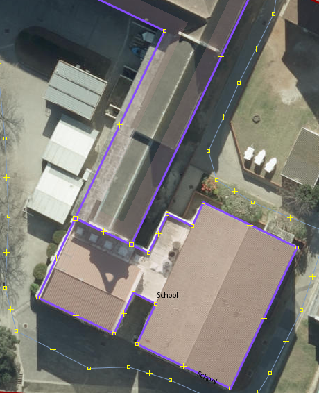
I work at a university (grande école) where the buildings are mapped like this. Despite being one large structure, it was not always the case. Building A and C were built in the 90s, building B in the early 2000s was built to connect them. We still use the different building names today and have A through H. D is a castle and F was only added last year, even though G and H are nearly as old as A and C. I feel bad for the amphitheatre being left out of the lettered naming scheme... Poor "AMPHI".
Perhaps your school was built building by building so they just added a new polygon instead of redrawing it.
Should I go change my school's buildings too?
I’m 99% sure that the building you see in my post was added after the original building. It’s all been built as one big building now though.
What I’ve done in some areas (after making it all one big building) is to add specific names/details as
building:part=yesbut not for everything