1
OpenStreetMap community
4181 readers
179 users here now
Everything #OpenStreetMap related is welcome: software releases, showing of your work, questions about how to tag something, as long as it has to do with OpenStreetMap or OpenStreetMap-related software.
OpenStreetMap is a map of the world, created by people like you and free to use under an open license.
Join OpenStreetMap and start mapping: https://www.openstreetmap.org/.
There are many communication channels about OSM, many organized around a certain country or region. Discover them on https://openstreetmap.community/
https://mapcomplete.org/ is an easy-to-use website to view, edit and add points (such as shops, restaurants and others)
https://learnosm.org/en/ has a lot of information for beginners too.
founded 4 years ago
MODERATORS
2
3
4
5
6
7
8
9
65
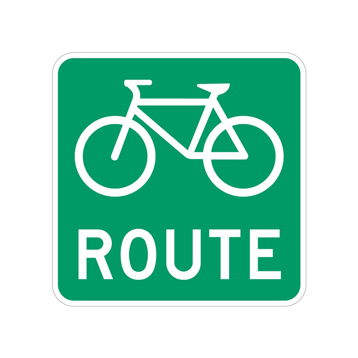
Best practice for tagging bike routes with no road markings (i.e. no sharrows or bike lanes)?
(lemmy.ca)
We have bike routes all over, and they are signed with something as shown.
But most of these will have a bike lane or sharrows along with the Bike Route signs.
However, I ran into one road that doesn't, it's just signed.
What's the best way to tag these roads? I don't want to cause confusion, but these unpainted (but signed) roads do actually lead to/from better cycling infrastructure, so they should be known.
UPDATE: Thanks for all the input, guys. Having looked into this further, I'm comfortable using the designated tag, at least for this specific road.
My municipality is a bit bipolar with their application of these signs. Most are signed as bike routes with toad markings, but a few are signed only.
Because these "bike routes" connect to more significant cycling infrastructure, I think its more than valid to tag them as “designated” as opposed to "yes" (which would be pretty much every road).
To add even more confusion to the situation, the official Cycling infrastructure map for my municipality seems to not include several areas that have both bike route signs and road markings, so i will ask them if the data is just lagging or if it needs to be updated.
So, unless there's a critical reason why the "designated" tag shouldn't be used in this context, I will leave it at that.
10
11
12
13
14
15
16
17
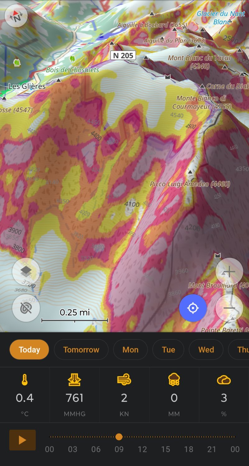
When I first tried OsmAnd a few years ago it was overwhelming, there is so much to customize.
I tried it again recently and it really impresses me.
My OsmAnd ski profile shows me slope for avalanche risk and 3D relief so I don't need Fatmap, plus OsmAnd let's you download 7days of weather.
OsmAnd doing routing on hiking trails replaces my need for Gaia.
Really impressive work by the OsmAnd team.
18
19
20
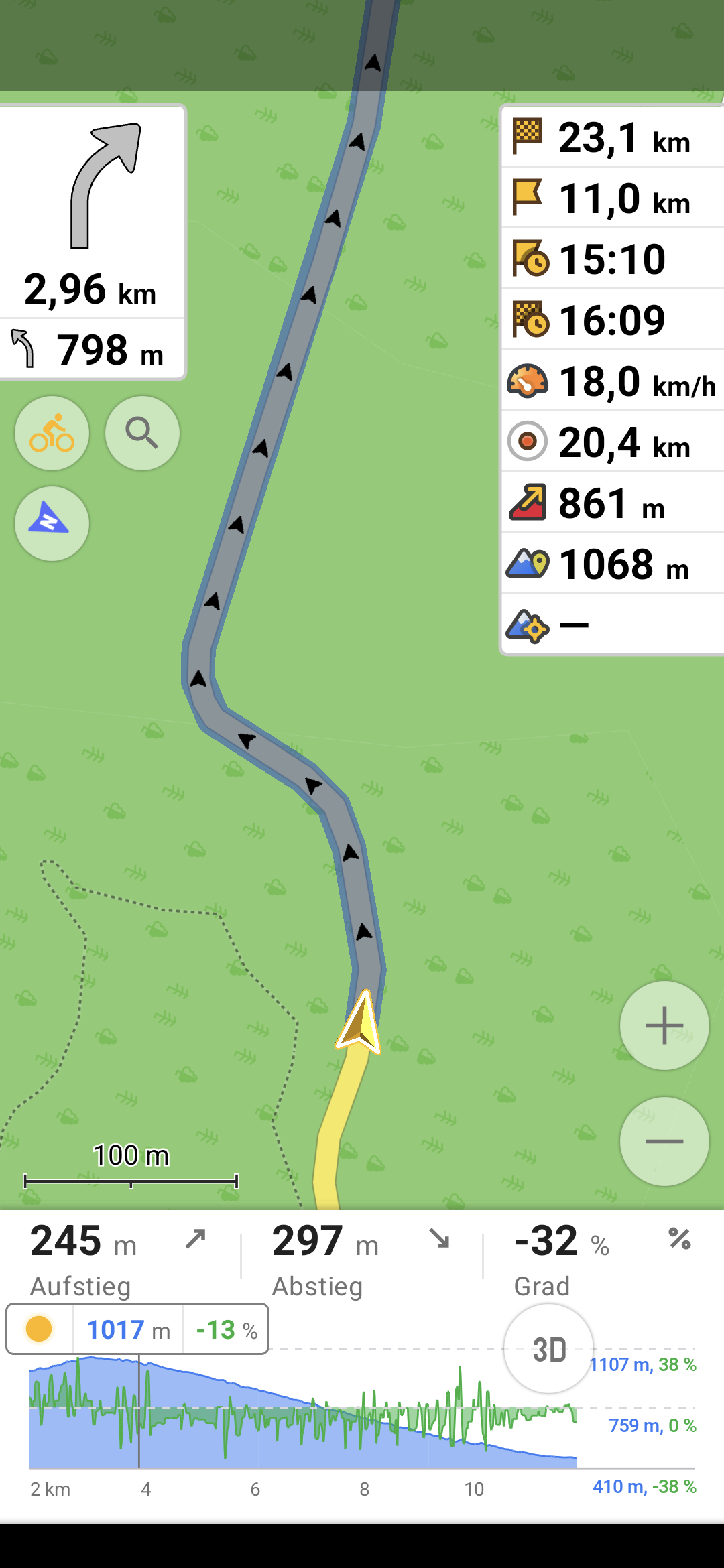
I am using a fresh osmand install, and now I have this widget on the right showing the wrong altitude. Always about 50m too high. The bottom widget shows the correct altitude however, that is kinda weird. I have updated the app now, but same thing.
Using f-droid latest version, but this happened also with the one I had before (4.85). I am also using brouter plugin for navigation, maybe the correct altitude comes from there idk. The wrong one is also displayed when in the default profile with no brouter involved.
Anybody else seeing this phenomenon?
Oh and the "centre map" altitude doesn't seem to be working at all, but I don't need that anyway.
21
22
23
24
25

view more: next ›