this post was submitted on 11 Nov 2024
37 points (66.4% liked)
Map Enthusiasts
3512 readers
448 users here now
For the map enthused!
Rules:
-
post relevant content: interesting, informative, and/or pretty maps
-
be nice
founded 2 years ago
MODERATORS
you are viewing a single comment's thread
view the rest of the comments
view the rest of the comments

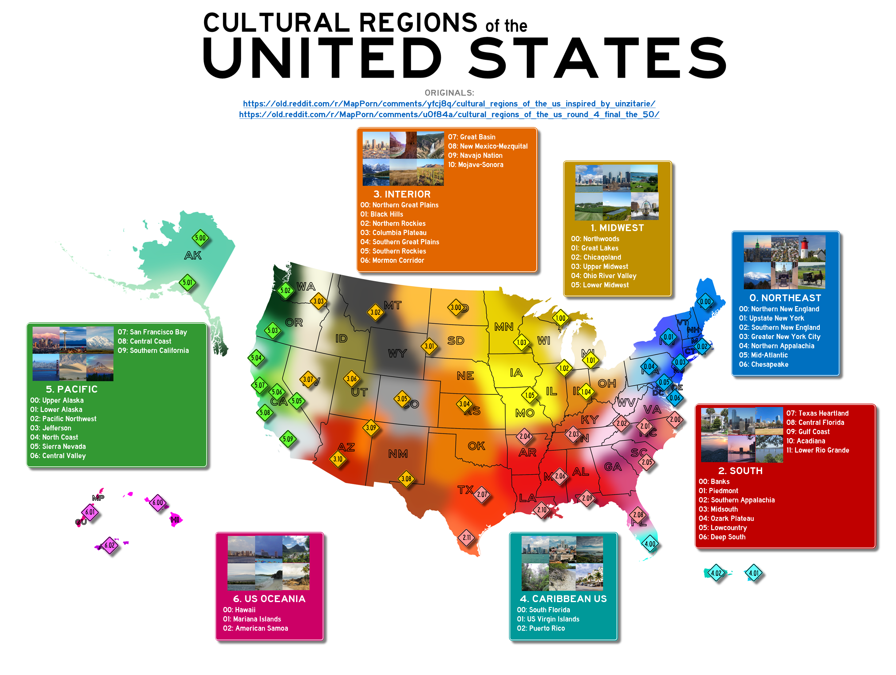
I have no idea where people who make this garbage get their info.
First, I see nothing "cultural" about these designations, these are regional designations.
I've lived or worked in quite a few of the places listed, and pretty much every one of those is inaccurate.
The "Chesapeake" label - I've never once heard that term used to describe that region, and I have family and friends who grew up there, and I've spent a lot of time there. If someone were to say "Chesapeake" they'd be asked what region of the Chesapeake they're referring to, as it's that large body of water there - the largest estuary in the world, if I remember right, or if they were referring to Chesapeake City, or just the Bay.
What's labeled the Gulf Coast of Florida, most people would call the Panhandle (which is considered part of the Gulf Coast, just has its own designation), with the rest of the Gulf Coast extending down the entire... Gulf Coast of Florida, which measures in the thousands of miles.
These maps keep showing up, and it's like they're done by someone who's never even read about any of the places, or looked at an actual map.
What about the unlabelled grey "dread zone" between the pacific and midwest areas? That's accurate, right?
Oh right, they marked that.
It's real, yeah. Don't go there. Wish I didn't.
Chesapeake just means "people who know that crabs are meant to be steamed, not boiled."
In my experience this is a surprisingly sharp cultural divide among places where eating crabs is common.